Research Projects
Urban Accessibility Research
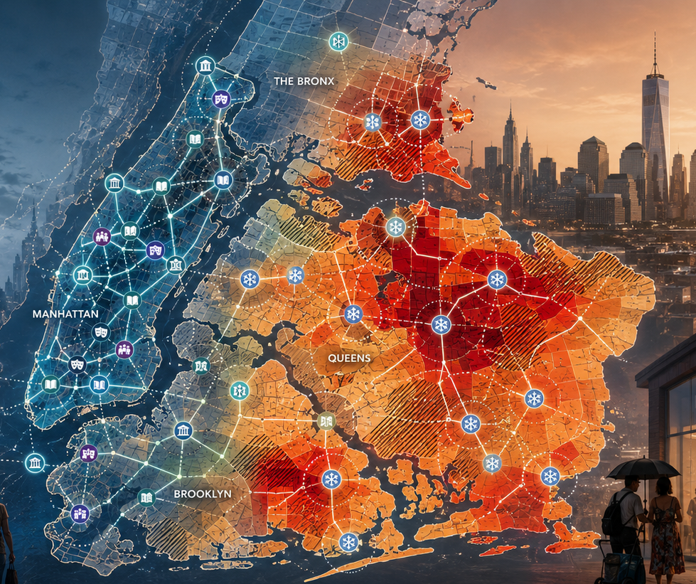
Investigating how access to essential urban amenities is distributed across socio-economic and environmental lines. One line of work maps cultural hubs and deserts across New York City and develops a Socio-Cultural Accessibility Score to identify underserved and overserved regions. A parallel line examines whether low-income residents living in the hottest census tracts have meaningful access to public cooling centers during extreme-heat events.
Reservoir Dynamics and Hydrological Impacts in the GBMIM Basin
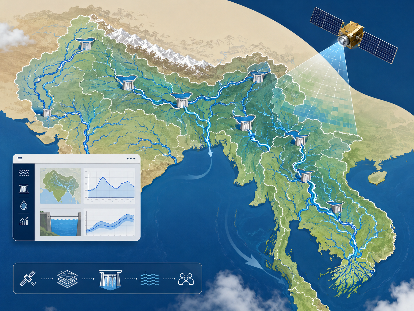
A basin-scale, satellite-based assessment of reservoir behavior and downstream hydrological impacts across the Ganges-Brahmaputra-Meghna-Indus-Mekong (GBMIM) river system. The project builds a 30-year monthly storage time series for more than 1,600 reservoirs, pairs each with its upstream catchment and GLDAS-derived hydroclimatic fluxes, and quantifies a Reservoir Impact Factor (RIF) to characterize how dams alter downstream flow. An interactive web portal makes the results explorable for researchers and water-resource decision-makers — see the live project website here.
Mapping Urban Pedestrian Infrastructure
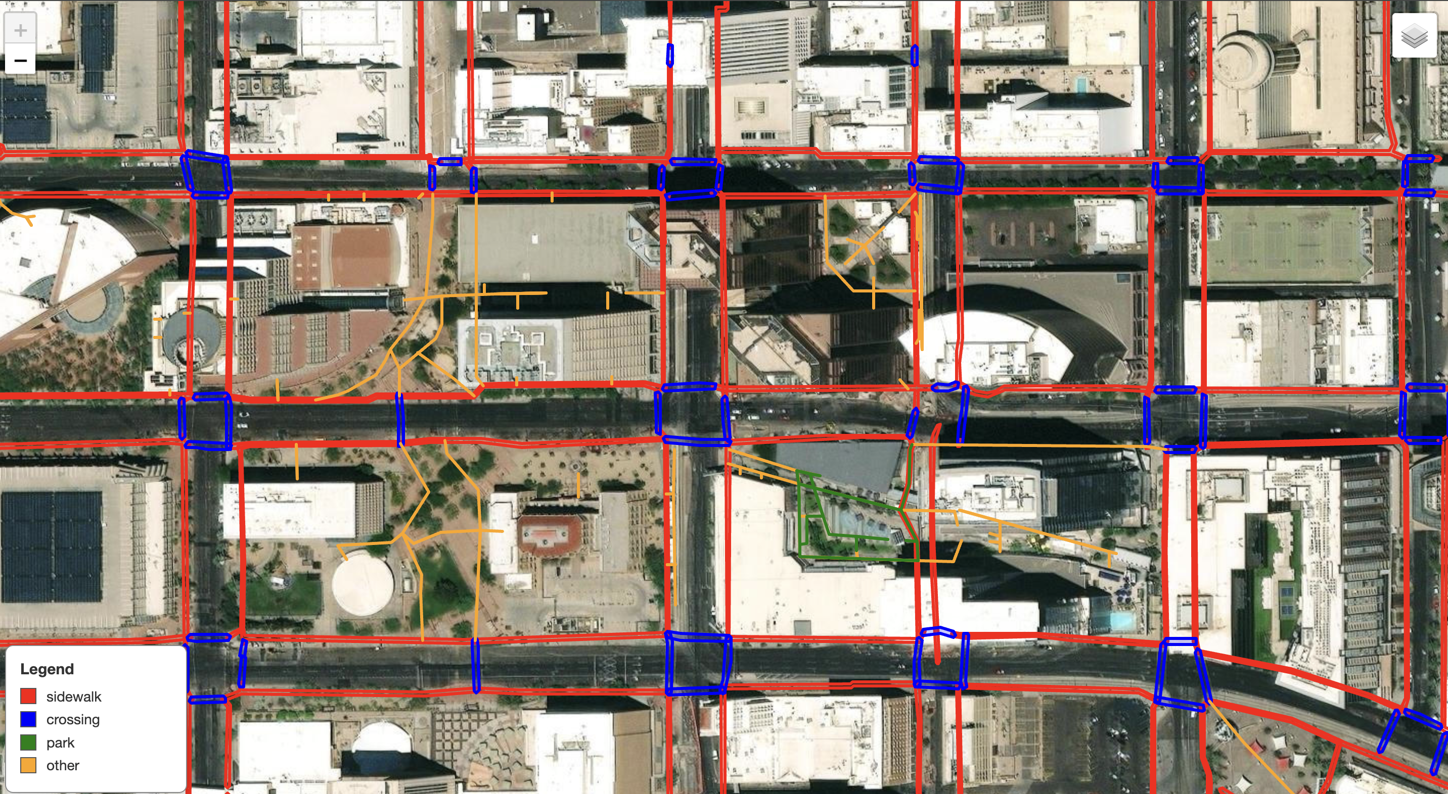
Building a scalable and vision-based framework to map urban pedestrian infrastructure (sidewalks, crosswalks, and public access paths) by integrating street-level imagery, segmentation models, and open geospatial data.

LiDAR-Based Urban Tree Mapping
An automated pipeline using LiDAR and ML to create a detailed and georeferenced tree inventory. LiDAR data is classified with NDVI, building, and land-cover layers, followed by individual tree segmentation via GDAL polygonization, clustering and SAMGeo. Morphological metrics are computed per tree, and trees are classified into mesic and xeric types.

Satire and Misinformation Detection
Developed and evaluated ML models — from traditional classifiers to transformer-based models (BERT, XLM-RoBERTa) — for fake and misleading news detection across multiple domains. SVM achieved 86% on small datasets; novel text-augmentation strategies pushed XLM-RoBERTa to 97%. BERT applied to Bengali misinformation yielded a 97% F1-score.